
UltraSystems Provides Environmental Resource Mapping to Support the City's Expanding Vegetation Management Program
Goats may not be the first thing that comes to mind when thinking about wildfire prevention, but in San Clemente they have become part of a broader strategy to manage hazardous vegetation. In February 2025, the City launched a pilot project near Vista Hermosa Sports Park using approximately 20 goats, two sheep, and one donkey to graze overgrown vegetation in open space near homes and public facilities. As the City explored expanding this approach, UltraSystems Environmental was brought in to support the environmental planning needed for the next phase.
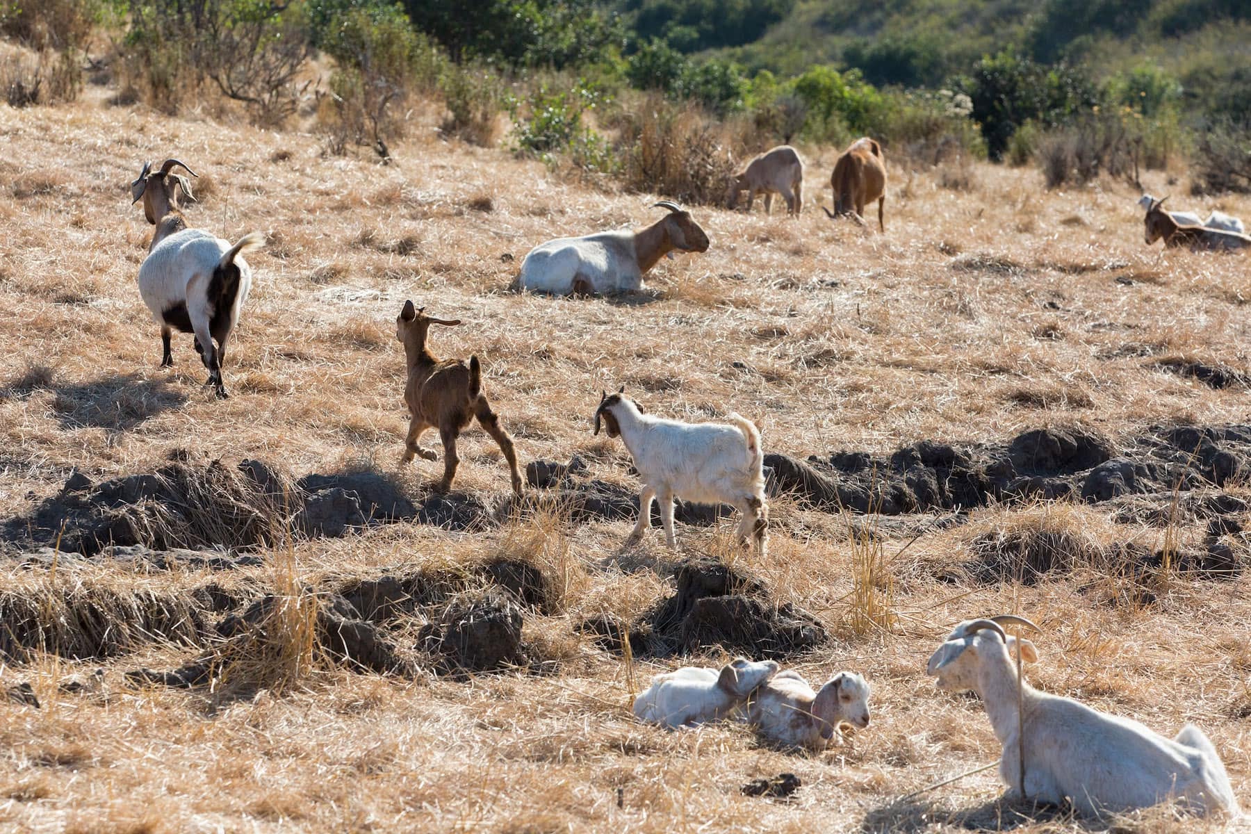
Photo: Goats grazing on Southern California.
Why Goat Grazing?
The City's initial Brush Clearance Site #1 covered approximately 33.7 acres with overgrown and invasive vegetation, including mustard and thistle. Controlled rotational grazing and electronic fencing helped keep the animals within designated treatment areas. Goats can move across steep or difficult terrain and consume brush, weeds, or other live vegetation, making targeted grazing one tool the City can use alongside other wildfire fuel-reduction methods.
Following the pilot project, San Clemente began evaluating how goat grazing could fit into a broader wildfire and vegetation-management program. Expanding treatment into additional open-space areas, however, required a closer look at the biological, cultural, and other environmental resources already present on those landscapes.
UltraSystems Role
To support the next phase of planning, the City of San Clemente retained UltraSystems Environmental, Inc. in December 2025 to provide environmental resource mapping, calculations, and technical information for its California Governor’s Office of Emergency Services (Cal OES) Hazard Mitigation Grant Program application for brush clearance using goats. The Project Mapping for the City of San Clemente was completed in January 2026 and focused on giving the City the environmental information needed to evaluate potential treatment areas.
UltraSystems prepared project-area mapping for species and habitat layers, wetlands, water bodies and riparian areas, California Natural Diversity Database (CNDDB) occurrences, and vegetation cover/CalVeg. The team applied buffers and documented where potential resources intersected the project area, or the distance to the nearest mapped resource, for use in the Environmental and Historic Preservation (EHP) checklist. This brought multiple biological datasets together in a form that could directly support the City's grant and planning process.
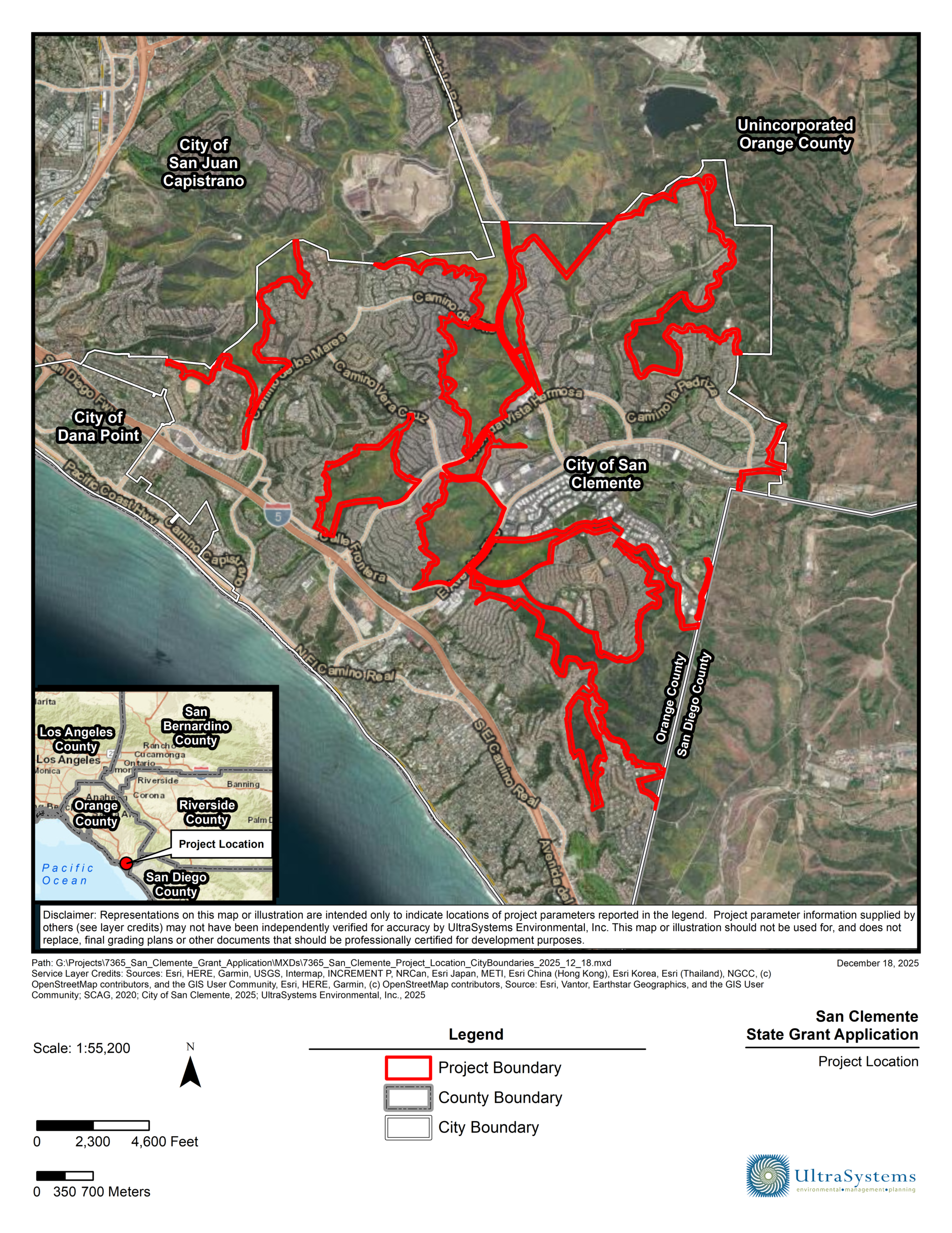
Photo: UltraSystems Illustration map showing site project.
Environmental and Cultural Resources Review
The biological screening demonstrated why site-specific planning matters. A U.S. Fish and Wildlife Service species list identified 19 threatened, endangered, proposed, or candidate species for consideration within the broader project area.
The federal review also identified mapped critical habitat overlapping portions of the project area for the coastal California gnatcatcher, arroyo toad, and Riverside fairy shrimp. These screening results identify resources that may need consideration during planning, but they did not mean that each species occurred within every grazing area.
UltraSystems also completed cultural and historic resource research through the California Historical Resources Information System (CHRIS) and the Native American Heritage Commission (NAHC). The CHRIS records search identified 23 previously recorded cultural resources overlapping the project boundary and 90 additional resources within one-half mile.
UltraSystems prepared a cultural resources memo and corresponding maps to help the City understand where known archaeological, historic, and tribal-resource considerations occur in relation to the proposed treatment areas.Together, the biological and cultural work provided the City with more than a map of where brush could be cleared. It provided a clearer environmental picture of the proposed treatment areas - information that can help guide where vegetation management may be appropriate and what additional considerations may be needed before work begins.
Looking Ahead
San Clemente's vegetation-management efforts have continued beyond the original pilot. In September 2026, the City's Open Space Wildfire and Vegetation Management - Hazardous Fuel Reduction program reached an implementation phase beginning with open space near Avenida Vista Hermosa.
The program combines goat grazing with hand crews, strategic mechanical vegetation removal, and native vegetation restoration to reduce fuel loads and create more fire-resilient open spaces. The goats may be the most visible part of the program, but the planning behind them is what helps turn an unconventional idea into an informed vegetation-management strategy. For UltraSystems, this project demonstrates how environmental resource research and mapping can support wildfire-resilience planning while keeping biological and cultural considerations in view before work begins.
For another example of how UltraSystems uses GIS to support vegetation management and protect sensitive environmental resources, explore our Santa Ana River Mainstem Habitat Mitigation & Restoration project.

About UltraSystems, founded in 1994, is a multi-disciplinary, full service environmental consulting and planning firm serving both the public and private sectors. The 30-year-old firm provides expertise in development planning; site selection and analysis; CEQA and NEPA compliance; technical studies, and environmental compliance during construction. UltraSystems Environmental is a certified DBE, SBE, and WBE company that is headquartered in Irvine, California.
Gabriela Cabrera BA, PGD is the Administrative Executive & Marketing Assistant at UltraSystems working on social media, newsletters, and proposals at the Irvine Headquarter office.