How UltraSystems Uses the Latest Drone Series to Evaluate Project Sites
UltraSystems Environmental, Inc. is a leading environmental consulting firm in Southern California with over 28 years of experience. As an industry leader, also recognized for staying up with the latest technology trends, we are well-equipped to better serve our clients. The advances in Unmanned Aircraft Systems (UAS) or drone technology has provided an opportunity to adopt its application in environmental consulting.
With drones, UltraSystems can offer our clients highly-specific data and imaging information as it pertains to their project. We are prepared to provide ariel surveys of project sites before work initiates and record footage after project completion for comparison. Other applications of drones in the field include land use monitoring, remote sensing and accessibility (areas that are difficult or unsafe for staff).
When it comes to biological and cultural survey work with drones, UltraSystems uses a great deal of caution. We understand the impact that drone usage could have on delicate, wildlife habitats and sensitive cultural environments. As environmentalists at heart – protecting native plant species and local wildlife is of the upmost importance to us and our licensed pilots share this unique perspective.
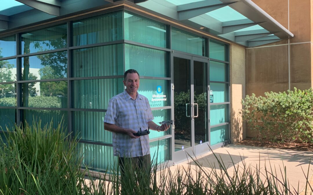
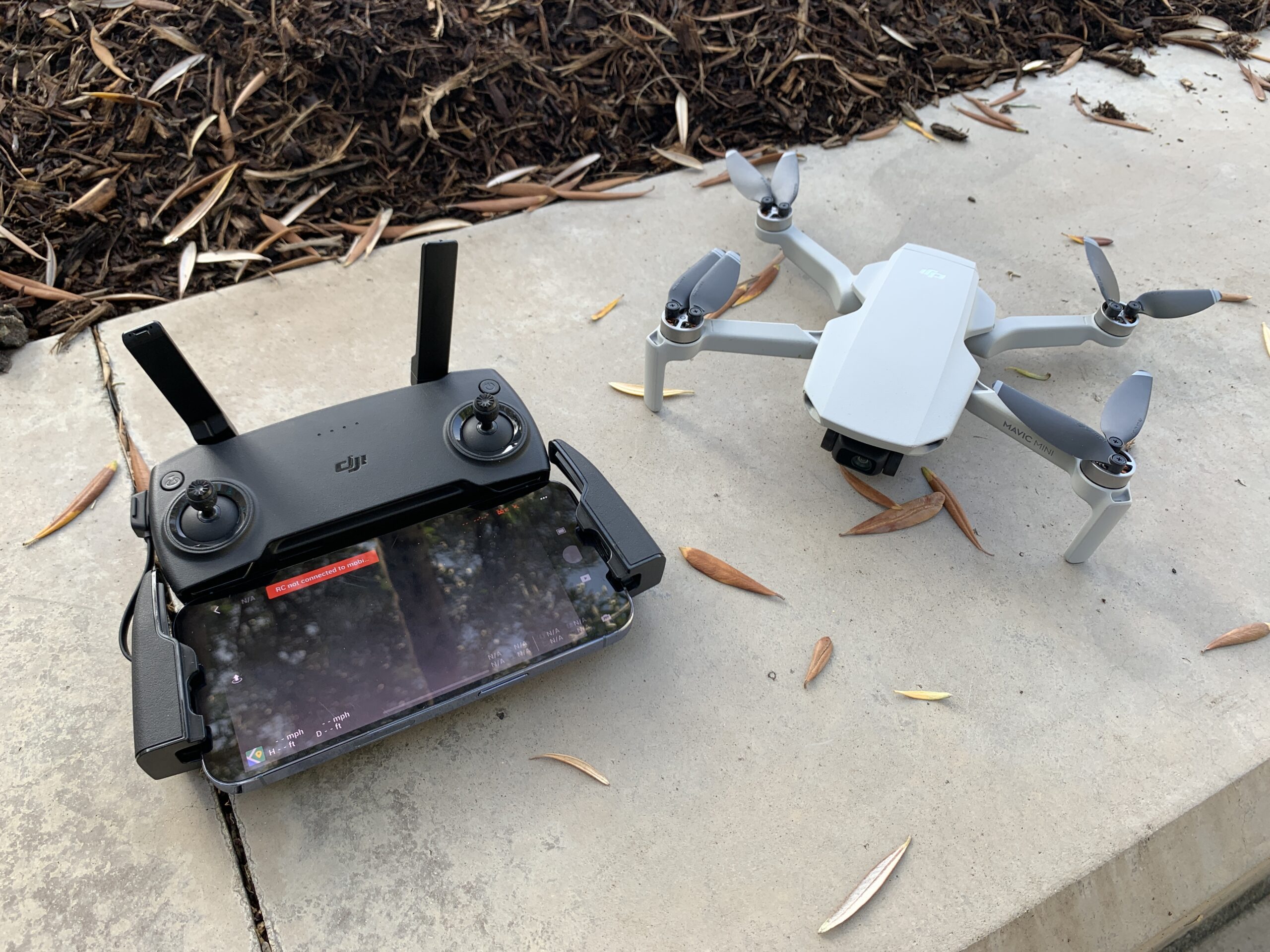
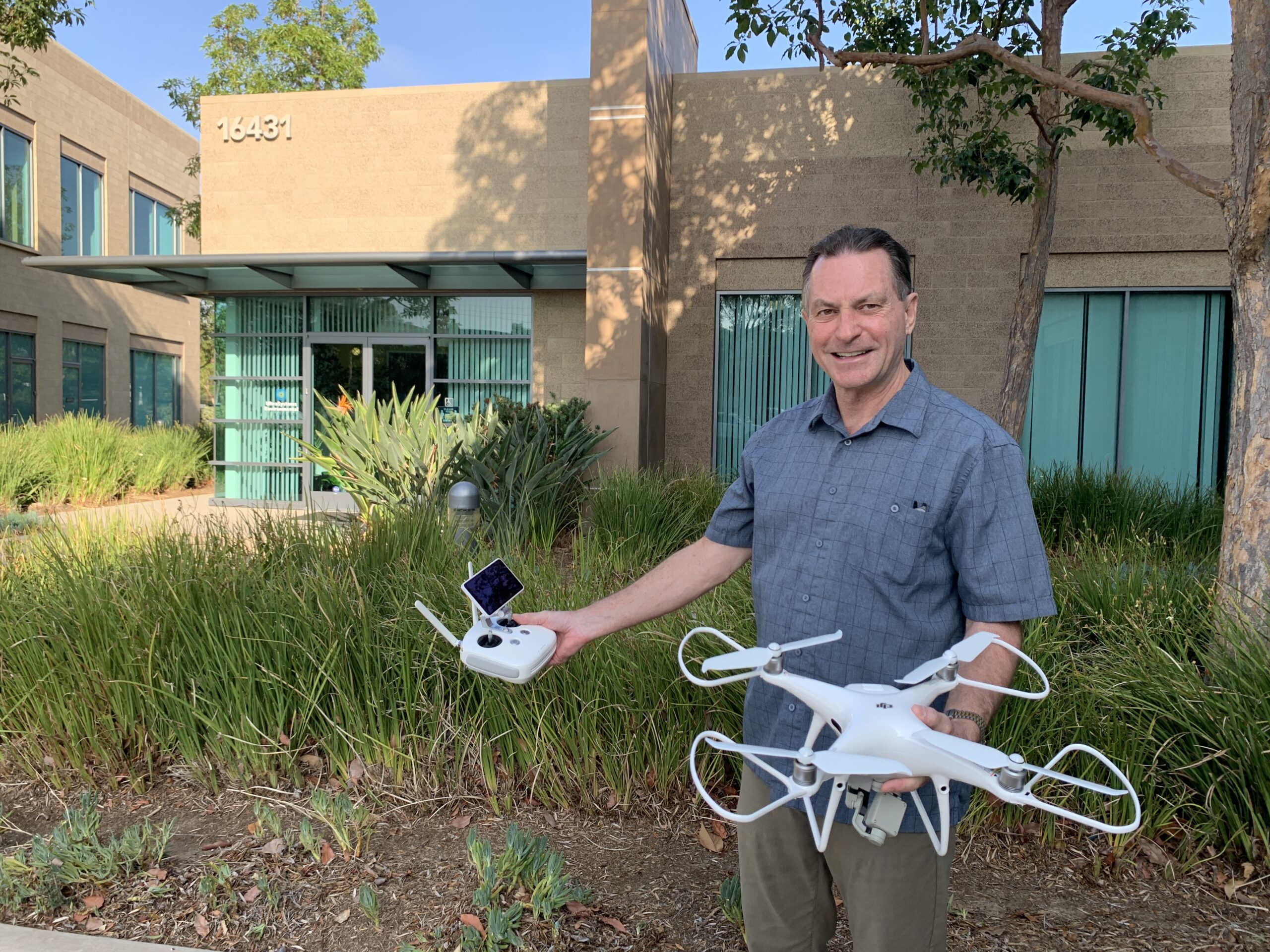
At UltraSystems Environmental we have two licensed drone pilots on staff. We always operate in compliance with FAA regulations and adhere to any and all flying restrictions. At this time, we operate two drones – the DJI Mavic Mini and the DJI Phantom 4 V2.0 – both of which are compact, yet powerful devices with diverse capabilities.
The Mavic Mini is an ideal drone for simple aerial surveys. This drone features a high-quality camera and video recorder and a 30-minute flight time. The smart return-to-home feature ensures that the drone will return to its home base despite a loss in signal connection, thereby protecting biological and cultural elements within sensitive areas.
The real powerhouse in our drone fleet is the Phantom 4 V2.0. This drone has a camera that shoots professional quality photos and video for our client’s needs. Equipped with five-direction obstacle sensing, the Phantom 4 is also highly rated for safety, control and precision. With the Phantom 4, our drone pilots can deliver high-quality images and video from difficult to access areas and remote locations.
According to Mike Lindsay, Director of Operations and Drone Pilot, “surveying with a drone expands the services that environmental and GIS professionals can provide to clients. With a drone, it is possible to carry out topographic surveys of the same quality as the highly-accurate measurements collected by traditional methods, but in a fraction of the time. This substantially reduces the cost of a site survey and the workload of specialists in the field. Capturing topographic data with a drone is up to five-times faster than with land-based methods and requires less staff. One drone flight can produce thousands of measurements which can be represented in different formats. We can also extract features from the images, such as signs, curbs, road markers, fire hydrants and drains.”
Mr. Lindsay continued, “From this data, a photogrammetry software can create geo-referenced orthomosaics, elevation models or 3D models of the project area. These maps can also be used to extract information such as highly-accurate distances or volumetric measurements. Survey drones generate high-resolution orthomosaics and detailed 3D models of areas where low-quality, outdated or even no data, are available. After post-processing with a photogrammetry software, these same images can produce very detailed elevation models, contour lines and breaklines, as well as 3D reconstructions of land sites or buildings. Specific project-related examples include tracing stormwater drainage to see where it terminates; accurately planning and blocking off wetland delineations; analyzing stockpiles of raw materials such as soil or gravel, and locating viable storage areas within complex construction sites.”
The opportunity to integrate drone data is truly endless. These are only a few examples of the ways that UltraSystems can bring comprehensive project analysis to our clients. The highly specific data that is provided by our drones deepens our understanding about a project and aids in the analysis and recommendations that we ultimately deliver to a client. We are excited to be able to offer our clients the benefits of an in-house UAS service.
Be sure to check out our Drone Pilot, Mike Lindsay, taking our Mavic Mini for a quick flight over our office headquarters in Irvine, CA on YouTube at: https://youtu.be/yI85V6m7NAc.
![]()
About DJI
At DJI, we give these creators the tools they need to bring their ideas to life. Our platforms empower them to capture images that were once out of reach. Our flying and camera stabilization systems redefine camera placement and motion. Amazing photos and video and high-end professional imagery are captured every day, in every corner of the world using DJI products.
![]()
About UltraSystems
UltraSystems, founded in 1994, is a multi-disciplinary, full-service environmental consulting and planning firm serving both the public and private sectors. The 28-year-old firm provides expertise in development planning; site selection and analysis; CEQA and NEPA compliance; technical studies, and environmental compliance during construction. UltraSystems Environmental is certified as a WBE, SBE, DBE and WOSB company and is headquartered in Irvine, California.
