UltraSystems Uses Trimble Devices for GPS Tracking of Biological Resources.
UltraSystems Environmental Inc. provides our clients with the best service possible by delivering the right expertise with a combination of people and technology. Our biological and cultural resource teams frequently use a Trimble device that has GPS linked software to map project sites, record environmental assets, monitor wildlife, track archaeological finds and conduct land surveys. By connecting the physical and digital worlds, UltraSystems brings specificity and precision to projects that would otherwise be impossible.
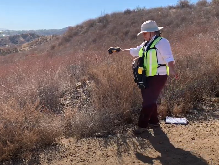
Featured Photo (above): Michelle T., Senior Biologist onsite using a Trimble at the Butterfield Overland Stage Route project in Lake Elsinore, California.
A handheld Trimble device has proven to be the ideal piece of equipment for our UltraSystems’ biological and cultural resource team members. Designed for accuracy and ease, the lightweight device is GNSS (Global Navigation Satellite System) integrated for rapid geospatial data collection. It offers location accuracy between .5 and 1 meter, an impressive and necessary level for our field work (the average phone GPS is 6 meters). Our biologists and anthropologists use Trimble devices in combination with TerraSync field software to map water delineations, conduct tree and wildlife surveys, and record cultural objects found.
Our Senior Biologist, Michelle Tollett, shares, “When I’m out in the field I rely on the Trimble technology to translate physical landmarks into data points in a map that can be analyzed throughout the project. It allows me, and my team, to be more efficient in the field and more accurate in our analysis for our clients. A Trimble device is invaluable to the project team.”
Once the data is collected with the Trimble device, a GIS map is created for a comprehensive depiction of the site. With such specific detail, UltraSystems can analyze all the data and identify issues, monitor change and make recommendations that adhere to CEQA (California Environmental Quality Act) and NEPA (National Environmental Policy Act) guidelines.
The Trimble Device on a Project Site
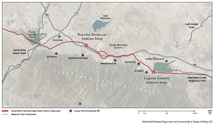
UltraSystems is currently conducting a biological assessment for the Butterfield Overland Stage route in Riverside County and using a Trimble device to build its evaluation and analysis of the project site. In 2013, a multi-agency team began exploring opportunities for development of a multi-use recreational trail following the historic alignment of the Butterfield Overland Stage route through Temescal Valley along the Temescal Wash corridor, from the City of Lake Elsinore to the City of Corona. This multi-agency team, that includes city and county representatives as well as federal agencies such as the US Forest Service, are committed to developing and protecting this trail once used as part of a national mail delivery system that ran from the eastern cities of St. Louis, MO and Memphis, TN to San Francisco, CA. The hope is that one day the Butterfield Overland Trail segment will be included in the National Historic Trails system as a tourism pull to the region.
UltaSystems YouTube Channel: https://youtu.be/oGhqgFB5pe4
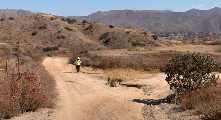
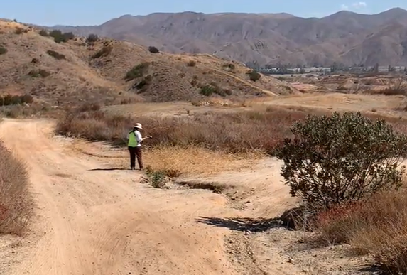
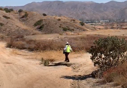
The photos and videos above show our Senior Biologist, Michelle, using a Trimble device to “walk the line” in order to plot a drainage wash found at the development site of Section 4, Alberhill Community near Lake Elsinore in Riverside County. The data points will be relayed to a satellite that will overlay existing information and allow our GIS experts to create a map for the Biological Resources team to evaluate and anticipate planning needs for the recreational trail.
Trail Project and Historical Overview Document
UltraSystems effectively and efficiently executes projects by optimizing our work processes through the use of technology including Trimble devices. The relative ease of data collection and the integration with GIS software means fewer team members need to be on site for the data collection phase and are instead focused on the data analysis phase. The Trimble devices ensure high quality, efficient modeling.
Ultimately, our clients are looking for the best possible data delivered on time and within budget. By including digital data sets in our reports, our clients are assured that their projects are completed according to plan.
![]()
About Trimble
Trimble is an industrial technology company, concentrated on helping the world work better. Their technology enables jobs to get done more precisely and accurately so clients can build, construct, grow and move the things needed to build future communities.
![]()
About UltraSystems
UltraSystems, founded in 1994, is a multi-disciplinary, full service environmental consulting and planning firm serving both the public and private sectors. The 28-year-old firm provides expertise in development planning; site selection and analysis; CEQA and NEPA compliance; technical studies, and environmental compliance during construction. UltraSystems Environmental is certified as a WBE, SBE, DBE and WOSB company and is headquartered in Irvine, California.