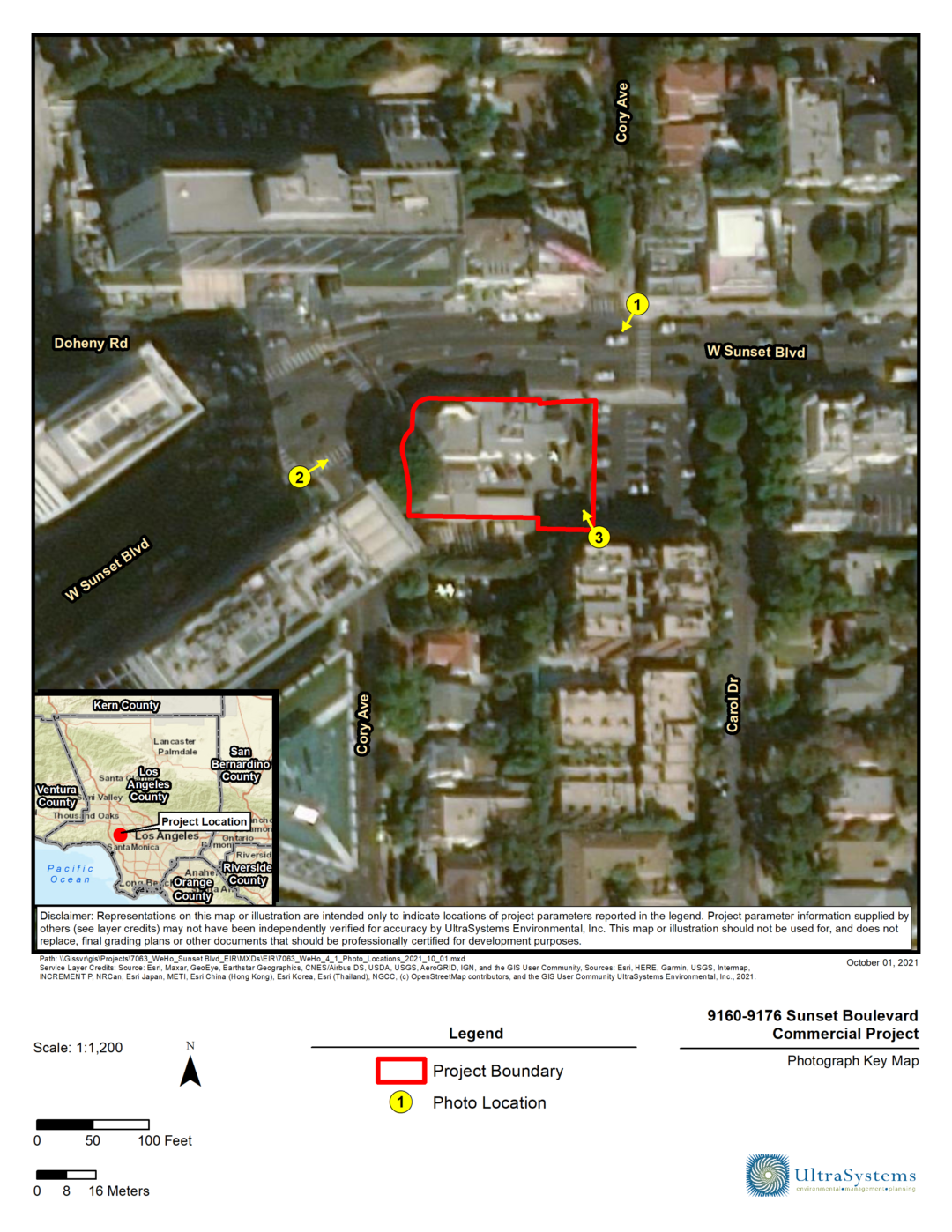
City of Fontana, Safe Routes to School
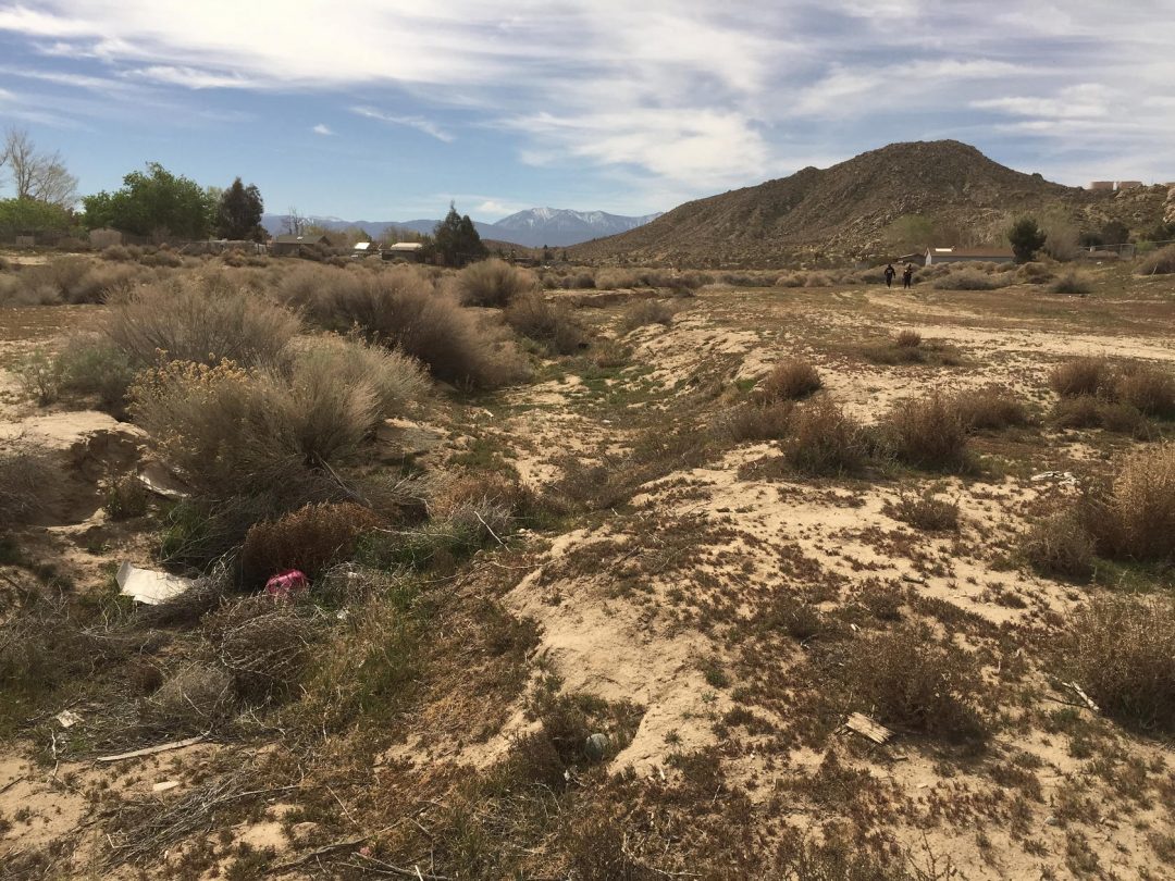
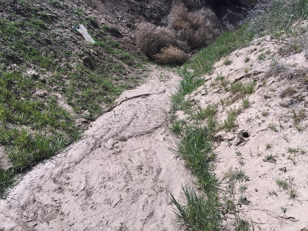
UltraSystems provided historical and archaeological cultural services for the City of Fontana’s Safe Routes to School Pedestrian Improvements Project. The Project consists of installing 1.25 miles of bicycle and pedestrian infrastructure including sidewalks, curbs and gutters, minor street widening for Class II bicycle lanes, 18 ADA compliant curb ramps, and signage and pavement restriping along Ramona Avenue, Alder Avenue, and Locust Avenue in north Fontana, San Bernardino County. The Project routes include 1,300 linear feet along Ramona Avenue (from Juniper to Sierra Avenues), 800 linear feet along Alder Avenue (from Baseline to Shamrock Avenues), and 5,300 linear feet along Locust Avenue (from Miller Avenue to Arrow Boulevard). The Project will create separate pathways for pedestrians, safely removing them from vehicular travel lanes, to provide sidewalks where there are none, and closing existing sidewalk gaps to improve connectivity for school children and residents. The improvements will benefit over 5,000 school children attending eight schools in the area and over 25,000 residents in the vicinity of the Project. This transportation Project is partially funded by the State of California under the Active Transportation Program Augmentation Program for the Safe Routes to Schools which entails coordination with Caltrans District 8 for National Environmental Policy Act compliance and Section 106 of the National Historic Preservation Act of 1966.
The City of Fontana’s Preliminary Environmental Study required an Environmental Assessment of the impacts of the Project, including preparation of a Historical Properties Survey Report (HPSR) which contains an Archaeological Survey Report (ASR). UltraSystems prepared the Area of Potential Effect (APE) maps as well as the ASR that were subsequently approved by Caltrans District 8 District Local Assistance Engineer and Senior Environmental Planner prior to commencing the cultural studies. The APE comprised a total of 20 acres subject to ground disturbance as well as 14 residential properties included due to potential effects and right-of-acquisition. The ASR included a site pedestrian survey of the grounds, a records and reports search at the South Central Coastal Information Center branch of the California Historic Information System, a Native American Heritage Commission search of their Sacred Lands File, and outreach with local Native American tribes in conjunction with the City’s Planning Department and Caltrans. Findings of the HPSR necessitated preparation of an Historical Resources Evaluation Report. Information from this report was used to prepare the HPSR that was approved by the City, Caltrans District 8, and the California Office of Historic Preservation.